
March 25-29, 2025 is Severe Weather Awareness Week for Nebraska and Iowa. Each day, a different aspect of severe weather will be highlighted, explaining the science behind them, and how you can stay safe when severe weather threatens. This article will focus on the criteria needed for a thunderstorm to be considered severe, and shows you how hail forms in a thunderstorm.
On average, the United States sees on average about 100,000 thunderstorms each year. Of these storms, around 10% reach severe criteria, capable of causing damage to property. In Omaha, we get around 40-60 thunderstorm days each year. Living here, we know these storms can be a lot stronger than ordinary thunderstorms elsewhere.
WHAT IS A SEVERE STORM?
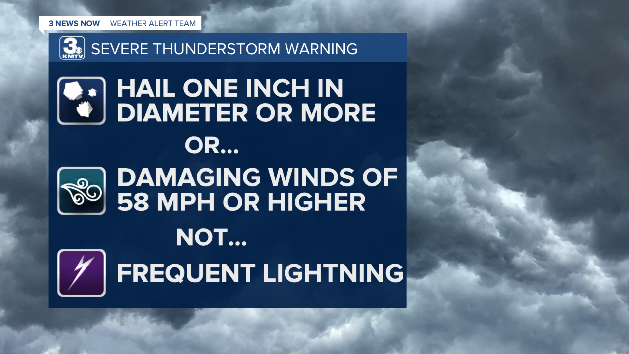
For a thunderstorm to be considered severe, it needs to meet either of the following criteria: hailstones larger than the size of a quarter (1") or wind gusts of 58 mph or greater. These numbers are because quarter-size hail or 60 mph wind is where damage can be done to property, such as cars, siding, rooftops, etc.
It is important to note that a severe thunderstorm is NOT defined by the frequency of lightning OR the amount of rain it produces.
SAFETY IN SEVERE THUNDERSTORMS
When thunderstorms threaten, there are a few things you can do to keep yourself safe. The most dangerous aspect of a thunderstorm is the lightning. Aside from flooding, lightning is the 2nd leading cause for fatalities from a thunderstorm. "When thunder roars, go indoors!"
If lightning were to strike your home, although rare, it could travel through electrical wiring or pipes. Therefore, avoid using any cabled electric items or get away from pipes. This includes not washing dishes or showering during thunderstorms.

For severe thunderstorms, the best way to protect yourself is to stay inside and stay away from windows. Hail or flying debris can break through windows and injure you. It is best to go to a lower floor into an interior space. If a tree falls, it can go through the roof, so it's best to avoid any top floors.
HOW HAIL FORMS
As a thunderstorm develops, usually within minutes the cloud will collapse under its own weight as the updraft, or column of warm, humid air, is no longer strong enough to support the development of the cumulus cloud.
Depending on how "unstable" or energized the atmosphere is, the updraft can rise at very fast rates and reach high in the atmosphere. Some clouds can tower over the Earth as high as 50,000 feet!

Inside the storm's updraft, the water molecules eventually freeze into ice crystals. There are millions of collisions occurring within the cloud, and these water/ice crystals begin to combine and grow larger as it rises higher in the thunderstorm. At some point, the ice will become too heavy for the thunderstorm to hold and it exits out the downdraft. These chunks of ice that fall are what we call hail.

Hail can come in many shapes and sizes. The smallest hail size is around 0.25", or a pea. Other sizes of hail commonly seen are: penny (0.75"), nickel (0.88"), quarter (1"), half dollar (1.25"), ping pong ball (1.5"), golf ball (1.75"), hen egg (2"), tennis ball (2.5"), baseball (2.75"), apple (3"), softball (4"), grapefruit (4.5"). Hail can grow even larger, the largest hailstone recorded in US history occurred in Vivian, South Dakota on July 23, 2010, which measured 8" in diameter! That is a bit less than soccer ball size hail!

Fun fact: the 2nd largest hailstone recorded in US history happened right here in Nebraska! In Aurora, east of Grand Island, on June 22, 2003. The hailstone measured around 7" in diameter!
