

Nebraska is no stranger to severe weather and tornadoes. After all, this is “tornado alley”.
Over the years, our understanding of storms and methods of prediction has only improved. There are parameters we use to help predict if conditions are right for severe weather, including tornadoes. Those parameters were “off the charts” on Arbor Day of last year.
One of those parameters in particular is wind shear, which is the change of wind speed and direction in the atmosphere.

The introduction of wind shear to thunderstorms helps stretch and tilt the storm's updraft, increasing the rotational speed of the updraft, which can lead to tornadoes if conditions are right.
More often than not, this added element of wind shear causes the storm to develop supercell characteristics, sending rain higher up into the cloud, allowing for it to freeze into hail. The extra turbulence caused from wind shear can lead to stronger storm-related wind gusts and downbursts.
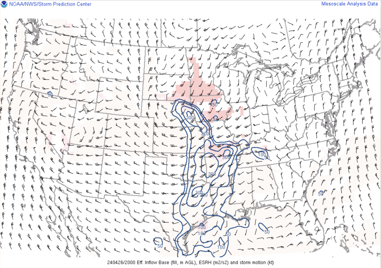
We can measure wind shear using a series of mathematical equations, using observations from weather balloon data, which is then modeled by super computers.
Here's a simplified example. Normally the wind shear is measured at a value of 100 for most large hail and damaging wind producing days. On days where tornadoes are possible, that value may be around 200. On Arbor Day, that value was around 300. Here is a screenshot of that data as the tornadoes were happening.
We knew as early as that morning that conditions were very favorable for tornadoes when a lone supercell thunderstorm had already been producing a tornado in central Nebraska that morning. To not only see a supercell thunderstorm producing a tornado that early in the morning was uncommon, but for it to have a 'long-track' tornado was very rare.
Fast-forward to later in that day, and a warm front had begun lifting into eastern Nebraska. Warm fronts provide lots of latent heat and moisture. It also provides lots of wind shear, but mainly at 7,000 to 15,000 ft in the air. While this would normally lead to ordinary strong thunderstorms, the added element of ground-level wind shear that day helped these thunderstorms rotate and become supercells capable of strong tornadoes.
What made the Arbor Day storms more unique is the 'long track' nature of the tornadoes. Normally, tornadoes will develop and lift all within a minute. It's that fast! The Arbor Day tornadoes were on the ground for more than an hour.
Very high wind shear helps the thunderstorm updraft maintain its higher rotational speeds, which also maintains its supercell characteristics. Because the wind shear measured was very high that day, it allowed for the Elkhorn and Minden storms to continuously say on the ground for over 60 miles!
Download our apps today for all of our latest coverage.
Get the latest news and weather delivered straight to your inbox.
