
The weekend starts with a mix of sun and clouds, but we'll start to see some afternoon clouds move back over eastern Nebraska Saturday. The clouds will give way to a handful of spotty showers in the second half of the day, mainly in northeast Nebraska. The rest of us around Omaha will likely stay dry all day with highs in the mid 60s.
We will see lots of clouds on Sunday, but a breezy south wind will help really warm us up, back into the mid 70s. Once again, there may be a few spotty rain showers around during the day. This time, all of us could be clipped by a brief rain shower during the day.
The wind stays breezy Monday and it will be even warmer outside with highs in the mid 80s!
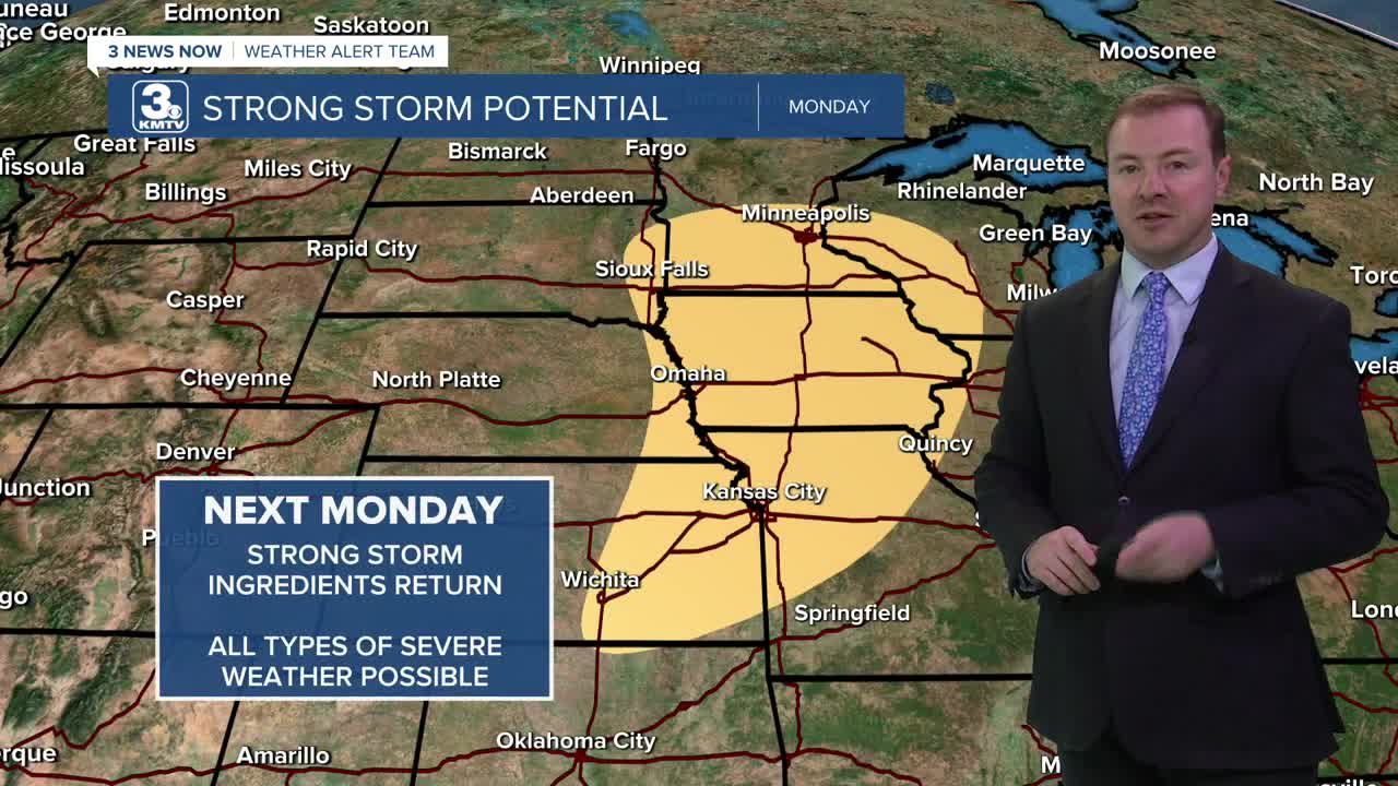
We are still monitoring for the potential of severe weather Monday afternoon through early Monday evening. A couple storms could start to pop up in eastern Nebraska early in the afternoon as a cold front begins to move through the region, but they will become more common in western Iowa and northwest Missouri by mid to late afternoon. Due to the arrival of the cold front and spotty nature of these storms, a number of neighborhoods will stay dry (especially in NE). All severe weather hazards will be possible Monday, especially very large hail, and the chance at tornadoes.
Behind Monday's storm system, it will be back to more average temperatures for the rest of next week. Tuesday will be partly cloudy with highs in the upper 60s.
We warm into the low 70s Wednesday and Thursday. We could see another opportunity for some rain Thursday, but for now, the chance is low.
SATURDAY
Partly Cloudy
Isolated Rain
High: 65
SATURDAY NIGHT
Partly Cloudy
Isolated Rain
Low: 51
SUNDAY
Mostly Cloudy
Breezy
Spotty Rain/Storms
High: 72
MONDAY
Partly Cloudy
Breezy
Spotty Strong Storms
High: 84
Share your weather pictures with KMTV:
- Email to News@3newsnow.com
- 3 News Now Facebook page
- Use the hashtag #3NewsNow on Instagram or X (formerly Twitter)
