
Forecasting snow already has its challenges. Forecasting snow where a key factor is a narrow band 20 miles wide that could mean the difference between 1" or 8" of snow makes it that much difficult. This was the situtation from our recent snow event from Saturday morning, where most would see under 3", some lucky (or unlucky) neighbors could see a lot more.
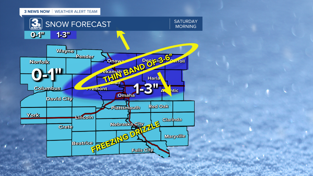
Our forecast called for around 1-3" with a heavier band of 3-6" possible in some location, we figured it would be just north of the core Omaha metro. And...that is exactly what happened. A band of heavy snow set up right along US-30 from Fremont to Denison, dropping 6+" of snow in a narrow window. Here are some totals from that heavier band:
Blair - 8"
Woodbine IA - 7"
Missouri Valley IA - 6"
Magnolia IA - 6"
Mondamin IA - 6"
Valley - 5.1"
Fremont - 5"
Carroll IA - 4.7"

If you drove from this band just 20 miles south into the core Omaha metro, those snow totals dropped dramatically, here are some snow totals from the Omaha metro:
Bennington - 3"
Northwest Omaha - 2.5"
Gretna - 2"
Boys Town - 1.7"
Eppley Airfield - 1.5"
Elkhorn - 1.1"
Sarpy County - Less than 1"
Plattsmouth - Dusting
Outside of Omaha, snow amounts remained under 3" for those who saw snow. Many south of the interstate recieved little to no snow, but some freezing drizzle led to some icy roads. Another exception was along US-81 where Platte/Madison Counties recieved some bigger snow totals:
Norfolk - 6"
Tarnov - 6"
Platte Center - 5"
Shelby - 3.2"
Wahoo - 3.2"
Lincoln - 3"
McCool Junction - 3"
Branched Oak Lake - 3"
Brainard - 2.5"
With 1.5" of snow at Eppley Airfield, that brings the official snow total for this winter in Omaha to 5.7", which would now bring us up to the 5th least snowy winter on record if winter stopped today!
