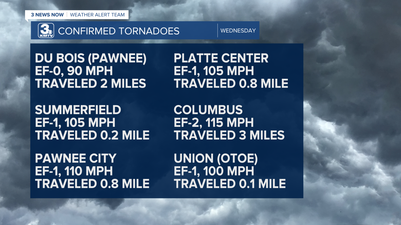
We are almost two weeks after the event, but I wanted to give you a final look at the weather event that brought 28 tornadoes to the KMTV viewing area on Wednesday, December 15th. It was a hectic weather day with record highs, numerous tornadoes, and incredibly strong wind gusts.
Before the storms got to Omaha, we set a record high not only for December 15th, but also an all-time record high temperature for the month of December when we hit 74 degrees Fahrenheit.

Not only was this a record high for the day and the month, but reaching 70 degrees in Omaha in December has only happened three other times since record keeping began.
December 10, 1890 - 71°
December 13, 1921 - 70°
December 6, 1939 - 72°
We began to see the storms get going in south-central Nebraska in the early afternoon and as expected, they quickly raced to the north and east through eastern Nebraska and western Iowa. Many of the storms were warned for 70-80 mph wind gusts with overall storm motion ranging from 70-100 mph.
Not only did we see many severe thunderstorm warnings, but we saw a slew of tornado warnings, too. Many of the tornadoes were fast-moving and embedded within the larger line of storms. Overall, we saw 2 EF-0 tornadoes, 16 EF-1 tornadoes, and 10 EF-2 tornadoes. Thankfully, no one was killed in these storms, but there were two injuries reported from Columbus and quite a bit of damage done across the area. Note, some of the tornado tracks are too short to show up clearly on the map, but they are still included in the lists.


For reference, here is a look at the Enhanced Fujita Scale:

Outside of tornadoes, many of us saw wind gusts between 70-95 mph. These strong winds could be found within the storms but continued on the back side of the system later in the evening, too.


For a look at some more stories and info from this weather event, check out the following articles:


