6:56 PM - Central Omaha Neighborhood reporter Hannah McIlree saw hail in people's yards. This was on 42nd Street and Leavenworth Street.


6:10 PM - Susan Miner shared this photo of flooding near the Westlawn-Hillcrest Funeral Home.

6:08 PM - Donna Goodman shared this photo of storm clouds near Stone Gate Lane.

6:03 PM - Disabled vehicles 50th and Saddle Creek.
5:54PM - Rushing waters near 49th and Poppleton.
Addie Cappellano shared this photo of hail near 74th and Center.

5:50 PM - Multiple reports of flooding around Midtown Omaha. Douglas County is under a Flash Flood Warning.
Here are two Creighton students describing what they saw from the flooding
5:44 PM - Jeanne Kros saw hail and rain on East Lime Kiln Rd. south of Crescent.

5:30 PM - Omaha is under a flash flood warning until 7:45pm.
3 News Now photographer Wade Lux saw this disabled vehicle on 49th Street and Saddlecreek Road due to the immense flooding.
5:05 PM - Deborah Swanson shared this photo of hail that fell in East Council Bluffs.

4:54 PM - The tornado warning for Douglas County has been lifted.
3 News Now photographer Kevin Rempe caught video of traffic on 25th Avenue and Cumming Street driving through flooded roads.
4:38 PM - Several metro-area neighborhoods are under a Tornado Warning, as KMTV meteorologists have detected broad rotation near the Missouri River. At this time, seek shelter in the lowest part of your home. Stay away from windows and doors.
Scattered thunderstorms will move through eastern Nebraska and western Iowa this evening. While not every storm will be severe, a few may produce large hail or a tornado. Follow along for live updates throughout the evening.
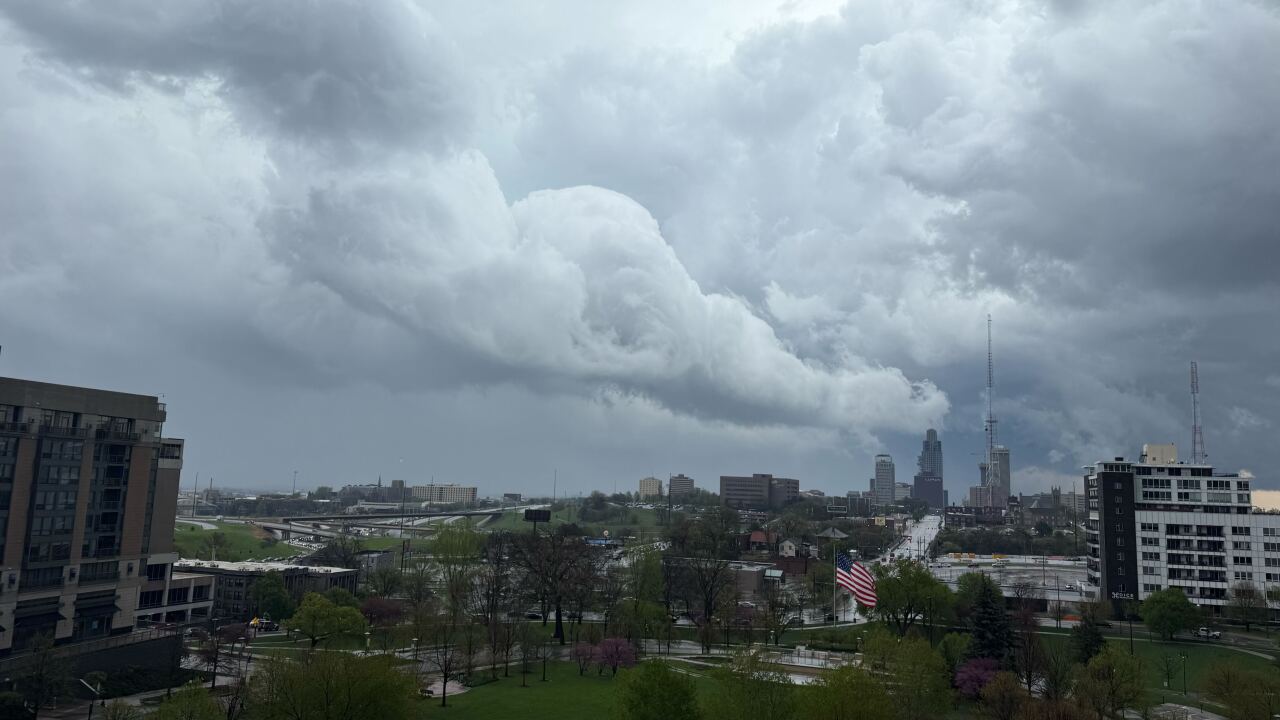
Here is a picture from a viewer of the storm clouds getting ready to cross over Downtown Omaha.
Weston, IA neighbor Dawn Douglas-Cipriano saw storm clouds bringing severe storms to Weston.

4:20 PM - Small hail in Central Omaha.
3 News Now photographer Kevin Rempe saw hail in an Omaha parking lot.
4:00 PM - Small hail has been reported in Papillion and La Vista from a storm, along with extremely heavy rain.
3:45 PM - The earlier tornado warning for Saline County has expired.
3:30 PM - Tornado Warning issued for Saline County, west of Lincoln. This storm has produced funnel clouds south of Friend.
