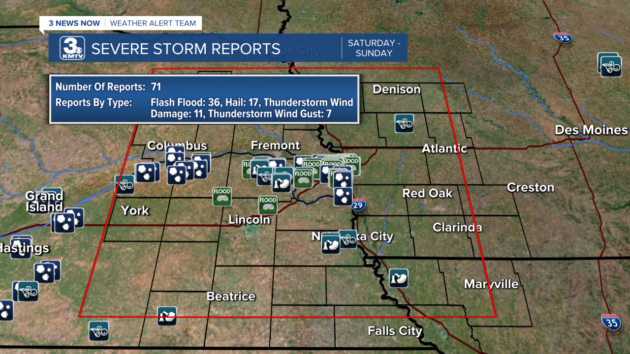
On Saturday night, August 7th, parts of Omaha saw some major flash flooding thanks to strong and severe storms that rolled through the area.
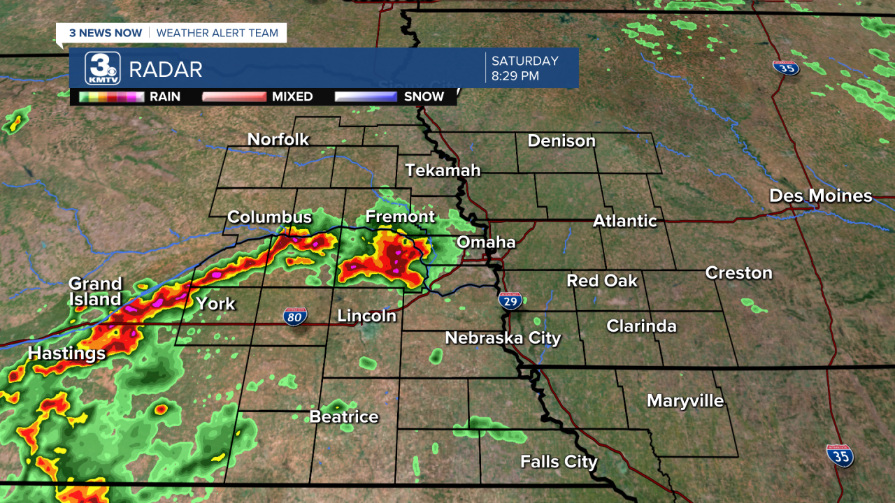
As the storms got going west of Omaha early Saturday evening, they eventually became severe and produced some damaging wind gusts between about 50-65 mph which caused some damage and uprooted some trees. The severe thunderstorm warning for part of the Omaha metro was issued just before 8:00 pm.


A wind gust of 63 mph was reported just to the west of Gretna, near Memphis. This was the same area that saw some more widespread tree damage.

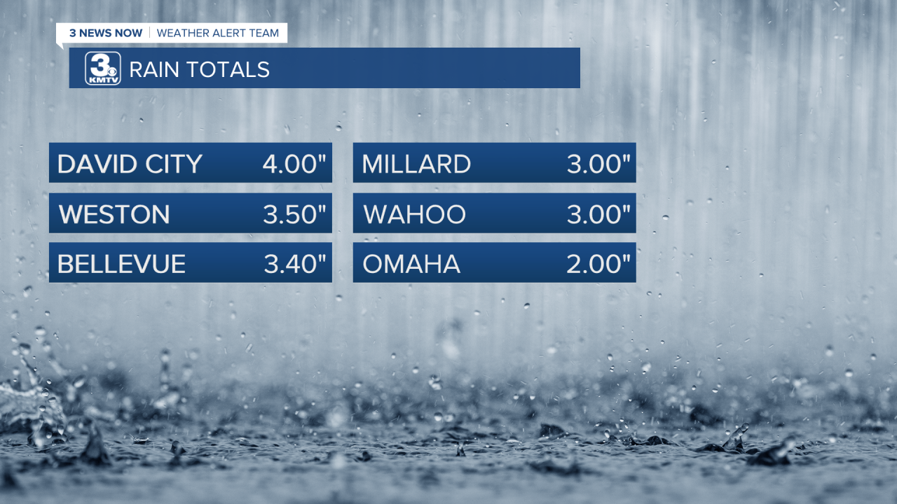
While damage like that is never good to see, of course the biggest story from Saturday night was the flash flooding. These storms produced an incredible amount of rain in a short amount of time. Storms moved over the same area, generally in a line from west to east just south of Highway 30 and just north of I-80. Rainfall rates were between 2-4 inches per hour and radar estimated rainfall totals ranged from 2-5+ inches!


Much of this rain fell in downtown Omaha on roads and sidewalks, which obviously don’t allow the rain to soak in as well. Granted, we saw other parts of the city deal with flash flooding because even dry ground can’t soak up 2-3 inches of rain when it falls in about an hour. It doesn’t take much for tree leaves and branches to also clog up some of the drainage systems around the city to also make flash flooding even worse.
We saw a LOT of pictures and videos shared of cars that got stuck in or had to be abandoned in flood waters. While flash flood waters do rise quickly and sometimes cars need to be abandoned for your personal safety, it’s important to remember to NEVER drive into floodwaters. It’s not always possible to tell if the road is compromised or completely washed away or how deep it might really be. “Turn Around, Don’t Drown!”


