What is sometimes considered the longest month (January) is now over! That means we’re on to February, so buckle up because the temperature roller coaster ride is underway. A lot of us in eastern Nebraska and western Iowa ended January with temperatures in the 50s and 60s but are starting the new month with highs in the 20s and 30s before highs in the teens are in play on Wednesday and Thursday. It doesn’t look like snow on the ground will slow down our warmup after this cold snap (since we’ve melted most of it), so back to the 40s and 50s we go next week!
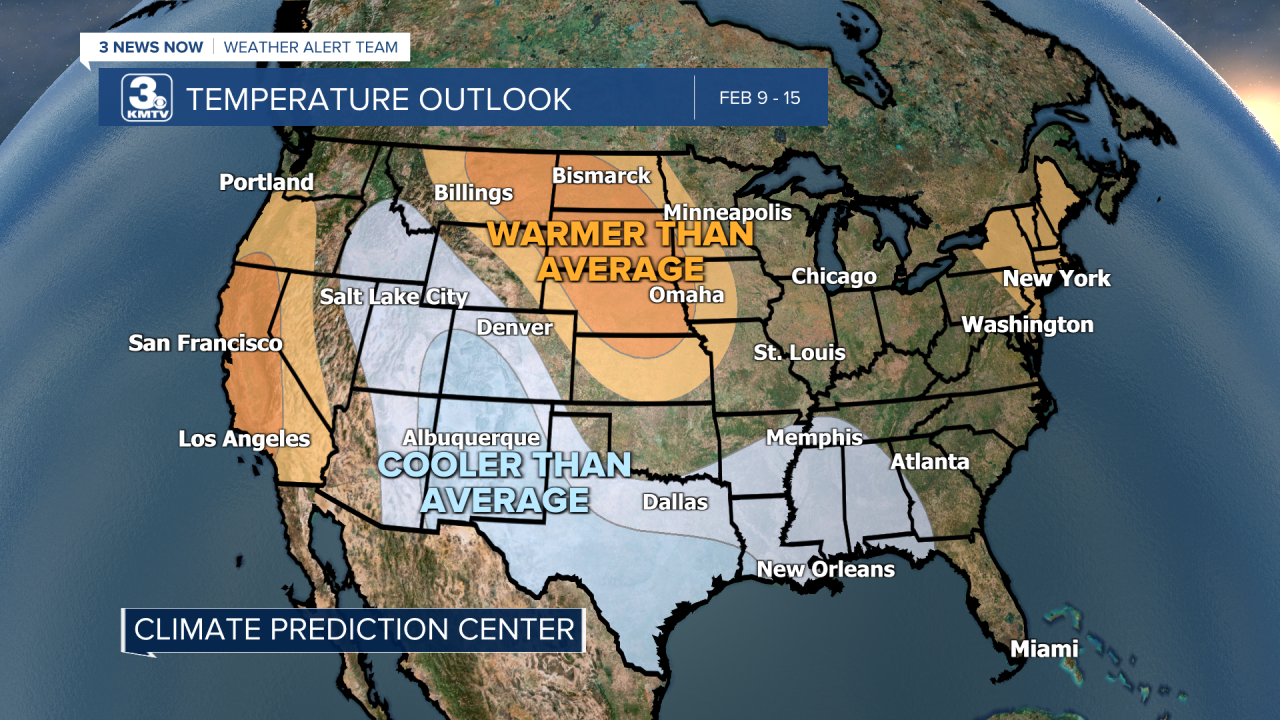
Let’s take a little peak at what the Climate Prediction shows for what's coming our way after this roller coaster week. The latest 8-14 day outlook shows a higher probably of warmer than average temperatures for all of Nebraska and most of Iowa. In that same time frame, the CPC shows the likelihood of near normal precipitation.


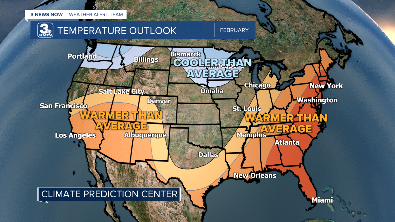
As for the entire month, the CPC shows the chance for below average temperatures in extreme northeastern Nebraska and northern Iowa and farther north. Warmer than average temperatures are more likely in the Southwest and much of the eastern half of the United States. As for precipitation during the month, better chances for above average precipitation will be up to our north and east with no clear signal either way for Nebraska and Iowa.


“But Audra,” you ask, “what ARE our averages for the month?” Well, dear reader, I’m happy to let you know! During the month of February Omaha sees an average high of 35 degrees to start the month, but we end it at an average high of 44 degrees. As for our lows, Omaha starts the month at an average low of 16 degrees and warms to an average low of 24 degrees by the 28th. For precipitation, Omaha typically sees just under an inch of rain and just under eight inches of snow.


