For the world, September 1 marks the start of meteorological fall! Now, you might be thinking "Doesn't fall begin on September 22 at 8:44 am?". While that date is the beginning of the fall season for most, it is technically the start of astronomical fall. For meteorologists, climatologists, and other record keepers, September 1 marks the start of meteorological fall. Meteorological seasons are mostly for record-keeping purposes because the start of those seasons begins on the 1st of a month (December 1 = winter, March 1 = spring, June 1 = summer, and September 1 = fall).
So with that out of the way, let's talk numbers. How did the summer (June-August) fare for Nebraska and Iowa in terms of temperature and rainfall? Was there anything noteworthy? As well, what could fall have in store for our area?
If we could sum up summer 2024 in one word, it would be: Average.
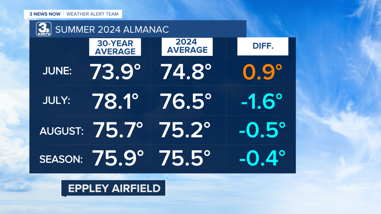
In the temperature realm, we hit the nail on the head with averages. It never got too hot, nor did it ever get too cool this season. June was a tad warmer in Omaha than average, while July and August fell a tad below average. The numbers are similar for Lincoln and Norfolk, which was near average if not just a touch warmer.
This summer, Omaha hit 90 or above for 27 days, just one above our average of 28. Lincoln hit 90 or above on 41 days, above the average of 35. Omaha had 3 days reach 100, which is on average. Lincoln had 6 days, which is also average.
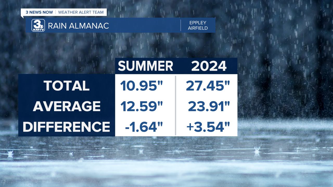
If we were seasonal in terms of temperature, a more notable difference from our seasonal norms was in rainfall. On average, Omaha gets just over 1 foot of rainfall for the season. This summer, we were on the drier side with 10.95" of rain. As a whole, our severe weather season was active. Although our severe weather events were not numerous, when they hit, it hit HARD. A few notable events this summer were the June 12 hailstorm in Omaha, the June 25 large hail/high wind event, and the July 31 windstorm.
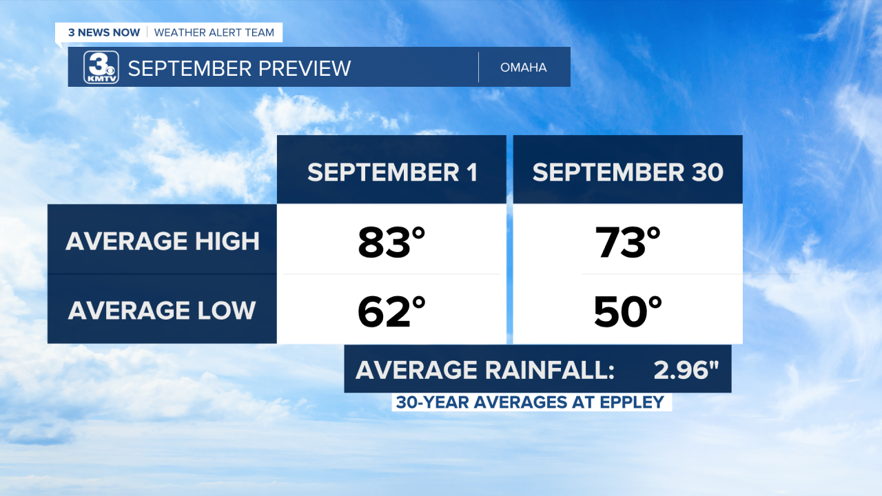
So, now that summer is over, what can we expect in fall? September is the month that begins our transition. We start the month in the 80s for highs and 60s for lows, and end the month with 70s for highs and 50s for lows. September is also one of the only months in Omaha where we have record highs above 100, and record lows below freezing. The earliest measurable snow (yes...I know) fell in September in Omaha, on September 29, 1985, with 0.3" of the white stuff.
Outlooks from the Climate Prediction Center overall are favoring a warmer-than-average month. On the flip side, a drier weather pattern looks to take hold in September, which could mean a drier September than normal. This does not mean it won't rain for the entire month, but rain events may be more sparse than usual.


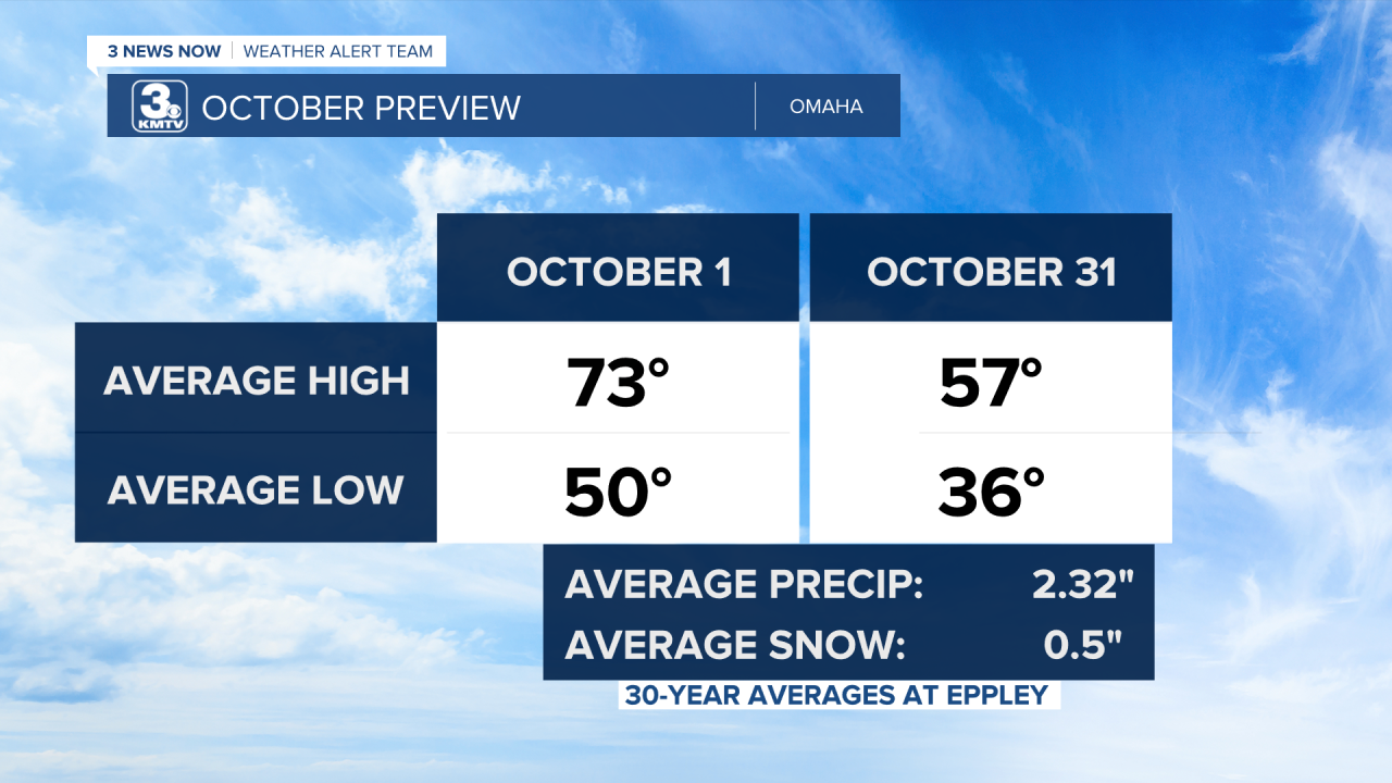
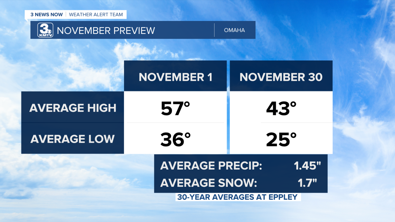
October is our main transition month for Fall. We start the month with 70s for highs and 50s for lows, and end the month with 50s for highs and 30s for lows. It is also the month when we start to see some early snowstorms, like the ones experienced in 1997 and 1991. November keeps up the colder and snowier trend as we start to look ahead to winter.
Outlooks from the Climate Prediction Center continue to broadly favor a warmer and drier pattern as we head into fall. This does NOT mean there won't be cold snaps or snow events. Keep updated with KMTV with the forecast for any near-term weather events.


With the severe weather season, we had this year, many have asked whether severe weather season is over. Check back to this blog tomorrow for the answer to that.


