

February in Nebraska and Iowa are typically associated with winter. Scenes of snow, ice, and very cold weather accompany the scenes of February. In fact, February is typically our snowiest months. Usually, tornadoes are not anticipated in February in Nebraska or Iowa during the month. However, in 2012 Nebraska saw what the equivalent of a February tornado outbreak is when 2 tornadoes added to the total tornado count for the month. Prior to 2012, Nebraska reported NO tornadoes in the state for the month. Meanwhile, Iowa only has 1 in Mason City from 1977.

TORNADOES IN FEBRUARY???
It is important to note that tornadoes do not know what "season" it is supposed to be, as December 15, 2021, taught us. All tornadoes need to form was four basic ingredients, which can in theory come together at any point in the year. Those ingredients were moisture, instability, shear, and lift.
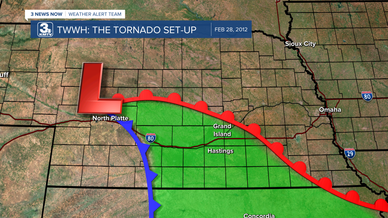
The storm system which lifted into Nebraska on February 28 was about as classic of a severe set-up as you can get in the state. A powerful low-pressure system developed in eastern Colorado and lifted northeast into Nebraska. The wind field was intense, as shown by the wind gusts upwards of 50mph when the system moved over. If this style of low-pressure moved through in May, we would have had a major tornado outbreak on our hands. This low-pressure system provided the energy needed to get storms going, what we call lift, a fancy term to say front or boundary. Lift = present.
Instead, it moved through in late February when the moisture is lacking. Despite the lack of moisture, there was enough to get thunderstorms going. The dew point, the measure of moisture in the atmosphere, was in the low 50s for southern Nebraska. While a dew point of 60 or higher is when we start talking about it feeling "humid out", dew points in the 50s in February is certainly enough to get the job done. Moisture = present.
With moisture comes instability, or the speed of the air rising into the atmosphere. In physics, you learn that less dense warm air wants to rise on top of more dense cold air. Although temperatures were only in the 50s, the temperatures just a few miles up in the atmosphere were much colder, below 0. As the warmer 50-degree air wants to rise, it quickly rises through the cold atmosphere until it loses enough energy through heat transfer to cool to the same temperature as the surrounding atmosphere. Once it cools, it saturates, becomes a liquid drop to form either clouds or rain. This is instability, and the cold temperatures in February meant we had some of it. Instability = present.
Finally, there is wind shear. Shear is a fancy term for changing of the wind with height in the atmosphere, either speed or direction. Speed shear refers to wind changing speeds with height. For example, if the wind at the ground is around 20 mph, but 10 miles above it is over 100 mph, you have ample speed shear. Directional shear refers to the change in wind direction with height. For example, if the wind at the ground is coming out of the southeast, but 5 miles up it is out of the due west, that is directional shear. If you visualize this directional shear, you can see the air rotating from SE to W, that rotation in the air is what creates rotating thunderstorms, and ultimately tornadoes. Shear = present.

With these four ingredients, the conditions for tornadoes in late February in Nebraska was there.
TWO WEAK TORNADOES IN NE
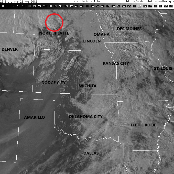
The first storms developed around North Platte and strengthened as they moved north of town. The first tornado touched down in extreme northern Lincoln County, the same county North Platte is in, and moved into Logan County. The tornado continued for several miles southwest of Stapleton, NE snapping a few trees and downing a center irrigation pivot. The tornado was captured by multiple storm chasers, whose videos can be found here, and here.


The second tornado touched down a few hours later north of Grand Island, just to the west of Greeley in Greeley County. This tornado was brief, only damaging an irrigation pivot. This tornado was also captured on video, which can be viewed here.


The storms ran out of instability as they approached Omaha, although thunder and lightning was reported in the metro as they moved through. That next morning, towns such as Stapleton woke up to a trace of snow, with some spots just a few counties north of the tornado picking up over 6" of snow!
PART OF A LARGER OUTBREAK
The two tornadoes which touched down in Nebraska on February 28 was only the first two in what was to be a much larger outbreak of tornadoes which lasted through the night of February 28 and into February 29. Storms developed in Kansas, where one EF-2 tornado did considerable damage southwest of Topeka. These storms raced across southern Missouri overnight, and quickly moved into southern Illinois and Kentucky during the day on February 29. In Missouri, an EF-2 tornado moved through the popular tourist city of Branson, causing significant damage to many attractions. That night, an EF-4 tornado laid waste to parts of Harrisburg, IL in the early morning hours. Finally, another EF-2 narrowly missed Elizabethtown, Kentucky. In all, 48 tornadoes touched down from Nebraska to Virginia during the Leap Year Tornado Outbreak of 2012.

