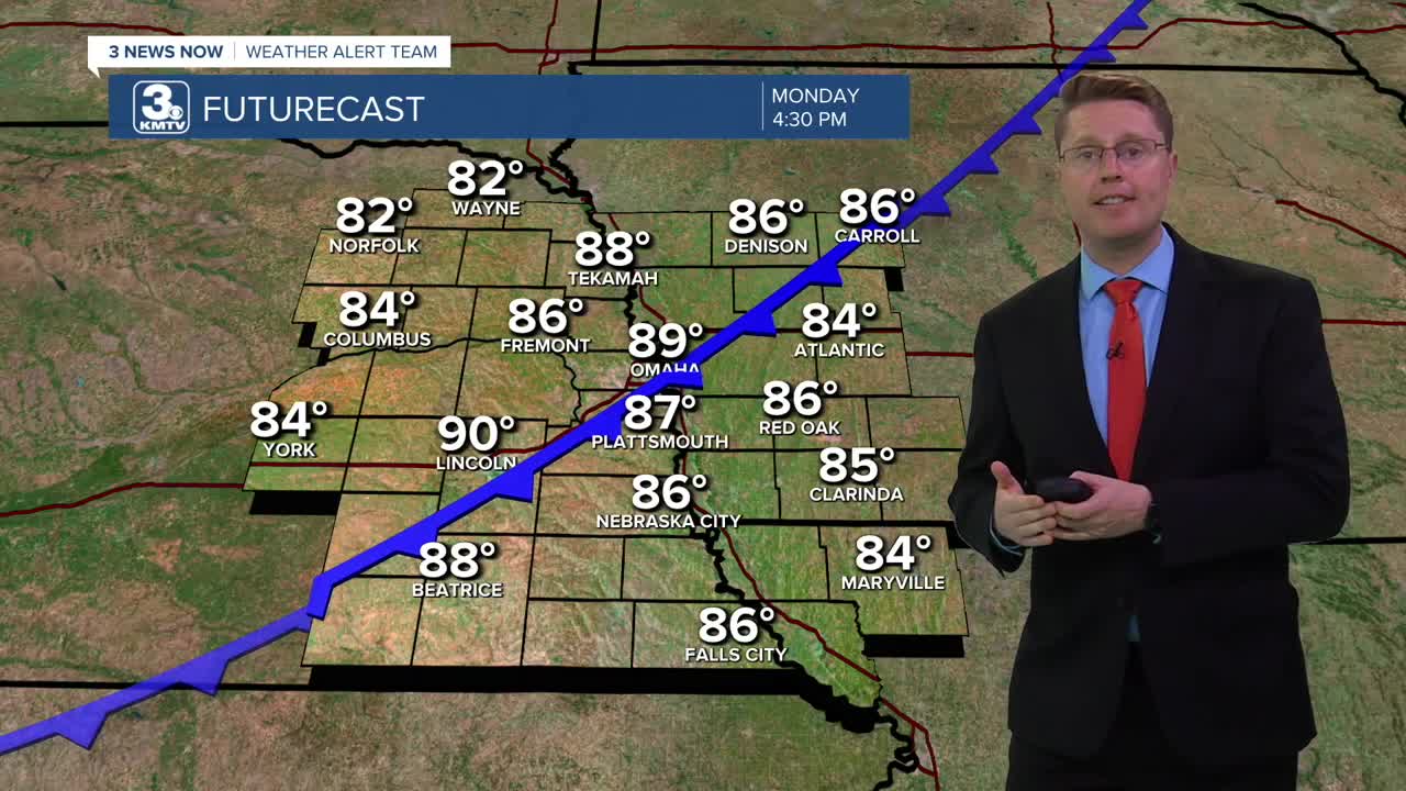


Our hot weather continues today with a lot of sunshine, but it won't last much longer. A cold front will move southeast through the region this afternoon and evening, finally bringing some heat relief. This will keep neighborhoods northwest of Omaha in the low and mid 80s today, but Omaha and areas farther southeast will have enough time to flirt with 90 degrees.
We stay dry as the cold front arrives, which means Omaha's 0.09" of rain this month will put us as the driest September since records began in 1871. The recent dry weather, today's low humidity, and strong wind behind the cold front will make for a very high fire danger from the afternoon into the night. Any fire could spread quickly out of control, so hold off on any outdoor burning or anything that could start a fire like tossing a cigarette out your car window.
The wind lightens up into Tuesday morning as we cool off to near 50 degrees. A lot of spots outside of the city will drop into the 40s.
We really notice the impacts of the cold front Tuesday afternoon. We will be in the low 70s with mostly sunny skies!
It gets breezy again Wednesday as warmer weather starts to blow back in. We'll make it into the low 80s and stay mostly sunny.
The wind lightens up Thursday, but the sunshine and low 80s stay.
We drop down into the upper 70s Friday with mostly sunny skies.
The weekend will be breezy and warmer with low 80s and a lot of sunshine both Saturday and Sunday.
MONDAY
Mostly Sunny
Windy Late
High: 89
MONDAY NIGHT
Mostly Clear
Windy
Low: 50
TUESDAY
Mostly Sunny
Cooler
High: 71
WEDNESDAY
Mostly Sunny
Breezy
High: 82
Share your weather pictures with KMTV:
- Email to News@3newsnow.com
- 3 News Now Facebook page
- Use the hashtag #3NewsNow on Instagram or X (formerly Twitter)
Download the free Storm Shield app for iOS and Android phones
Receive severe weather watches and warnings for your location as you track the storms on radar. Great for use at the office, at home, and while traveling.
