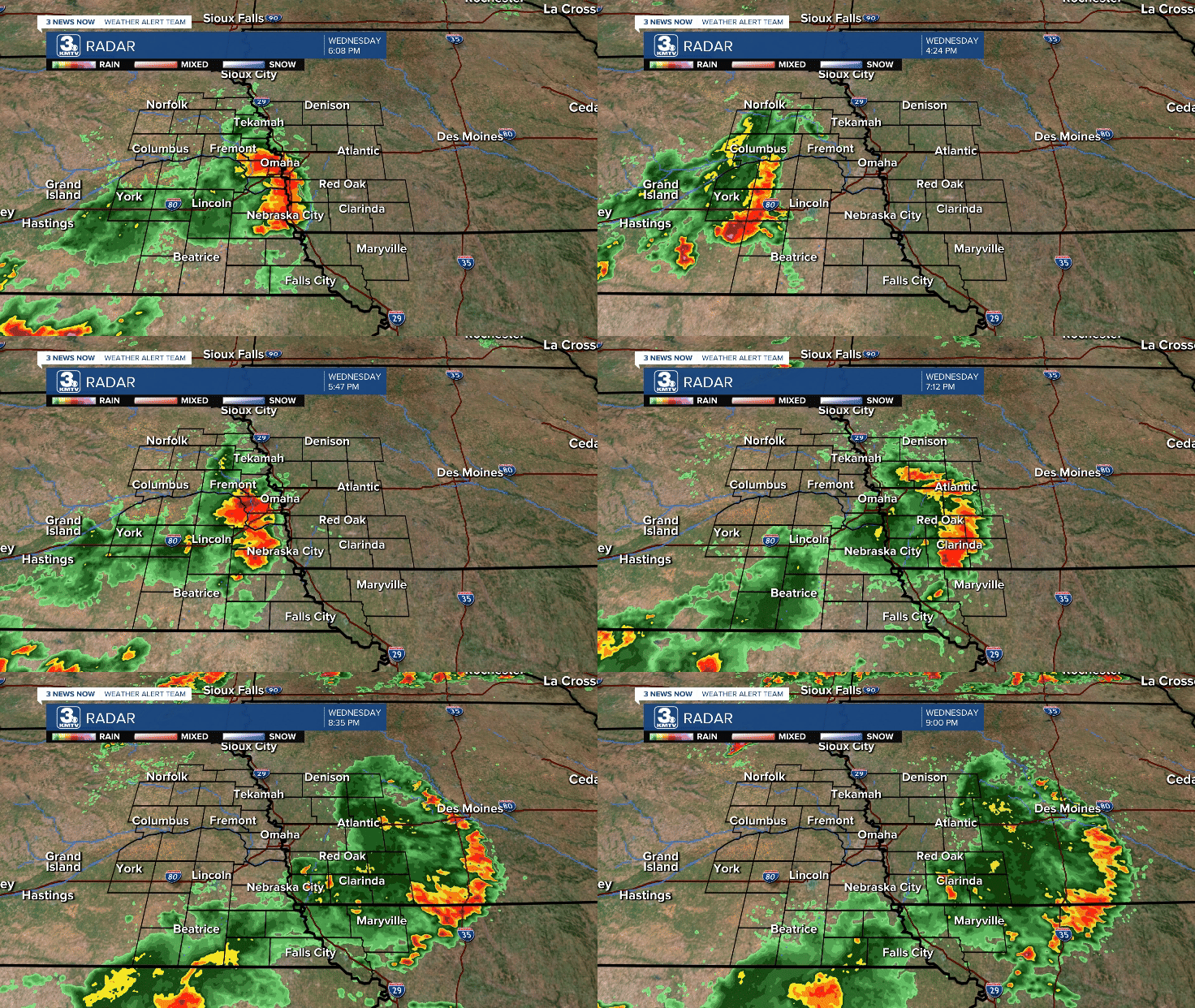
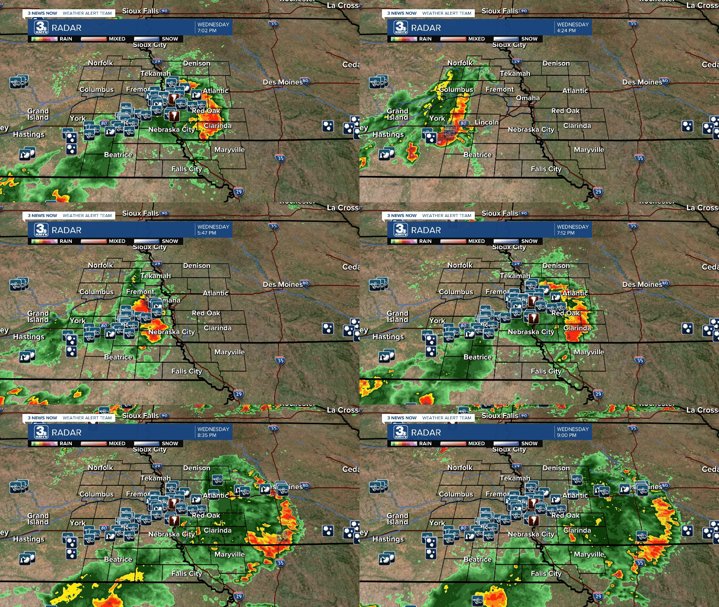
After days of sweltering heat and humidity, the atmosphere became a powder keg that needed a trigger to ignite. That trigger came as a cold front moved through Nebraska on Wednesday, July 31. The cold front sparked thunderstorms over central Nebraska, which initially struggled to intensify as it approached Lincoln.

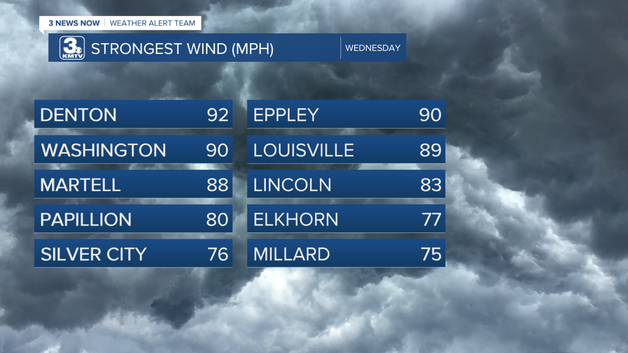
However, once the storms hit Lincoln, they hit the explosive atmosphere and intensified rapidly. Winds of 80-90 mph ripped through the city. Some of the peak wind gusts were 83 mph at the Lincoln Airport and a 92 mph wind gust near Denton. The storm toppled hundreds of trees, ran pieces of wood into the walls of homes, bent football goals, and even damaged a hotel roof near the Airport. The storm also knocked out power to over 30,000 customers in Lincoln.

The storms did not weaken as they headed into the Omaha metro. Winds between 75-90 mph swept over the metro causing widespread tree damage. Hardly a single neighborhood in the Omaha metro has no tree damage. Structural damage occurred to several buildings including Millard North Middle School, and commercial buildings near the Fire Station in Waterloo. It's going to take weeks to clean up all the damage and asses the costs. However, this will likely become one of the costliest storms in Omaha's history.

For coverage from our neighborhood reporters on the individual stories of damage, click here.
Omaha Eppley Airport recorded a wind gust of 90 mph, tied for the 4th highest wind gust (which was hit in June of this year...).

At its maximum, around 218k people in the OPPD coverage area were without power. This is the largest power outage in OPPD history (which dates back to 1946). This outranks the 2021 and 2008 windstorms and the big winter storms of the 1990s. OPPD estimates around 400k customers, meaning over half of the OPPD population was without power. It will take several days for everyone to get their power restored.

Most, if not all, of the damage was caused by straight-line winds. Straight-line winds can do as much damage as a weak tornado. A 90 mph wind from a tornado versus a 90 mph wind gust is the same. Although a tornado warning was issued with these storms, no tornadoes have been confirmed by the National Weather Service at this time.
Although a technical issue, this storm is NOT a derecho. A derecho is defined by the Storm Prediction Center (SPC) as a long-lived windstorm that produces consistent wind damage over a path of at least 400 miles and must be at least 60 miles in width. The windstorm on July 31 traveled only 230 miles from west of Lincoln to east of Des Moines. The width was also less than 60 miles. An example of a derecho would be the storms that came through Omaha on the morning of May 24th.
Despite the technical definition, the July 31 windstorm will go down in history in a year riddled with historic Omaha weather events.


