


On March 1, 1950, the West Side Baptist Church in Beatrice exploded at 7:25 p.m. In the church were 15 choir members who practiced at 7:20, five minutes before the explosion. Fearing the worst, the crowd gathered around the church and watched in awe as the 15 members of the choir pulled up to see the damage. Through a seemingly mundane series of events, every single one of the 15 choir members was late. The reasons why ran from car troubles, soiled clothes that needed ironing, waking up late from a nap, getting caught talking to people, listening to a radio program that ended at 7:30, working on homework, and more reasons. This seemingly miraculous event is still discussed in popular media today such as being an episode of Unsolved Mysteries.
Like the schoolhouse tornado in 1928, tornadoes can often have these seemingly miraculous events and circumstances that can save the lives of people. In 1973, a tornado tore through Gage County which flattened homes but killed no one in Nebraska. The Blue Springs tornado was part of a larger outbreak that impacted parts of Kansas, an outbreak for which little actual information is known. In this installment of This Week in Weather History, we travel back to the 1970s to look at a violent tornado that moved through Gage County.
1973: A WATERSHED YEAR IN WEATHER HISTORY
After being discovered by accident, weather radars became a key feature in detecting and tracking significant weather. In 1973, the weather radar in use was the WSR-57 (Weather Surveillance Radar, the 57 denotes the year 1957 when the radars were implemented). These primitive radars worked by sending out a beam of radio waves in all directions, and those beams would bounce off objects such as rain, hail, snow, or tornadic debris and be bounced back to the antenna. The result was a grainy black-and-white image of blobs on a screen, where precipitation was denoted.

In the early 1970s, meteorologists were experimenting with a new radar technology known as Doppler radar. Doppler radar was useful in not only detecting where the precipitation inside the storm is but how fast and in what direction it is moving. Known as velocity, the outcome is the red/green radar image you see on TV today. In 1973, the uses of this technology were still murky, but the answer would become clear soon.

On May 24, 1973, an F-4 tornado hit the town of Union City, Okla. This was the first tornado to have its entire life cycle documented by Doppler radar, although the discoveries would not be known until months later. By using both the radar and velocity data, detecting tornadoes would become much easier due to this new technology.
SEPTEMBER 25, 1973: THE SET-UP
This new innovation of Doppler radar was unknown when a severe weather set-up began on Sept. 25. A slow-moving low-pressure system meandered across the Great Plains. The result of this was days of rain across much of the central U.S. In Omaha, between Sept. 23 and Sept. 28, 6.67" of rain fell, including 3.53" on Sept. 25 alone! This deluge of rain caused significant flooding across Nebraska, Kansas, and Iowa in the days following the tornado outbreak.

Further south, warm unstable air was overlaid with cooler Canadian air across Kansas into southern Nebraska. Ahead of a cold front, the wind shear within the region was very favorable for tornadoes. By the afternoon of Sept. 25, numerous storms developed in central Kansas and lifted northeast, producing several strong tornadoes as they approached the Nebraska/Kansas state line.
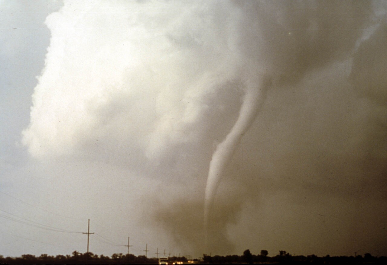
THE TORNADOES OF SEPTEMBER 25
The tornado outbreak of Sept. 25, 1973, remains somewhat of a mystery. No extensive survey of the tornadoes was done, meaning the exact number of tornadoes and their tracks is unknown. However, there were at least five, likely many more, which moved from central Kansas into southern Nebraska.

The collection of tornadoes began south of Salina, passing just west of Linsborg where it was filmed by a local farmer.
The tornado continued into the far southeast corner of Salina, a town in Kansas of around 40,000 people. In Salina, the tornado (rated F-3) hit a trailer park where 84 people lived, 80 of them heeded the warnings and took shelter underground, meaning no one was injured as the tornado crossed through.
The tornadoes continued to the northeast, hitting the small town of Niles just northeast of Salina. Eight homes in the town were destroyed, and a cafe was hit too. A woman died in the cafe when she was hit by flying debris. The tornado continued over mostly open country after Niles.

The next town to be impacted in Kansas was Clay Center, a population of 5,000. The F-3 tornado hit the western side of town, damaging 250 homes and destroying a few. The tornado hit the hospital, injuring 22 people but killing no one. It continued northeast, hitting the town of Greenleaf head-on. In the town of 450, every home was damaged or destroyed, and two people lost their lives.

The tornado cluster then crossed into Nebraska and intensified, achieving F-4 and perhaps F-5 intensity as it passed just west of Wymore and Blue Springs. At one home, a family was just arriving from a school board meeting when the tornado swept away the home. The family huddled in the car as the rest of their house was gone, but the car remained intact as the only thing standing. Some might call it a miracle, but the miracle of 1950 lives on.

This tornado continued east of Beatrice before lifting southwest of Adams, doing more significant damage to many homes across Gage County.
In all, damage across Kansas into southern Nebraska was in the millions. Despite the amount of damage, five people were killed in the tornadoes and over 50 injured. However, the death toll could have been higher had warnings not been heeded.
