
Although recently we are drought-free, since the summer of 2022 parts of Nebraska and Iowa have been under some significant drought. The worst occurred in eastern Nebraska where extreme (4/5) and exceptional (5/5) drought categories have blanketed most of the area. For some, the recent drought may have brought back memories of the major drought in the latter half of 2012 into 2013. In this installment of This Week in Weather History, let's look at the causes and impacts of the worst drought on the Great Plains in recent memory.
CAUSES OF THE 2012 DROUGHT
Beginning in late 2010, a strong La Nina (the term referring to the cooler-than-average waters in the equatorial Pacific that has an impact on US weather patterns) brought abnormally hot and dry conditions to much of the southern US through 2011. States like Texas, Louisiana, Oklahoma, and New Mexico experienced one of the hottest and driest summers on record. This led to significant drought conditions over the region.

Heading into the winter of 2011-2012, the broader weather pattern did not favor an active snowy pattern over the US. Omaha picked up around 20" of snow when the average is closer to 27". Likewise, the winter of 2011-2012 was warm relatively speaking. Omaha tied the monthly high-temperature record for January when the city hit 69 degrees on January 30.
This dry and warm pattern peaked in March when a "heat wave" developed over the Midwest. For Omaha, 2012 was the warmest March on record with the monthly average temperature being 56.4 degrees, which is 16 degrees above average!
In May, things began to shift. It continued to be very warm, the month ended up about 5 degrees above average in Omaha. As it got warmer, dry weather also settled into Nebraska and Iowa with May recording about 50-75% of the monthly average rainfall. This continued into June when the hot and dry weather began to dry up the land, and the drought started to settle in.
THE 2012 DROUGHT
Then came July, when a manageable situation spiraled out of control for Nebraska and Iowa. First came the heat. A large dome of high pressure moved from Baja California to the Midwest in the final days of June and would sit over much of the country through the entirety of July. The result was the most severe heat wave in recent US history. Before the heat finally let up in August, the 2012 heat wave claimed 82 lives.
In Omaha, July 2012 hardly saw a day drop below 90 degrees. The worst heat began around July 12 and continued through the rest of July, where high temperatures exceeded 95 almost daily. The average temperature for July was 84.8 degrees, about 7 degrees above the monthly average. This makes it the 4th hottest July on record after the July of the 1930s. On the flip side, no rain fell in Omaha, literally. For July, which sees about 3.55 of rain on average, Omaha Eppley Airfield picked up 0.01" of rain. Yes, you read that right.

As you may expect, the hot and dry conditions in July led to an explosion of the drought. At the beginning of the month, most of eastern Nebraska and western Iowa were drought-free, with most of western Nebraska and eastern Iowa in some form of drought. This rapidly changed by the end of the month. All of eastern Nebraska and western Iowa was in at least a level 3/5 "severe" drought, with other parts of the states in the "extreme" 4/5 or "exceptional" 5/5 drought categories.

In Nebraska, the Platte River dried up from the interchange with the Loup River and to the west. With water levels very low over eastern Nebraska as a consequence, protocols were put in place limiting the irrigation of crops as over-irrigation led to water levels becoming low in many wells. In some neighborhoods, water control measures to conserve water usage were enacted.

Although some rain and cooler weather returned to Nebraska and Iowa in August, it did not alleviate the drought much. At the end of August, most of eastern Nebraska and western Iowa was in the "extreme" 4/5 drought category. All the while, the exceptional drought category expanded over central Nebraska and moved eastward.
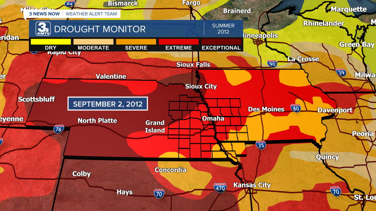
Heading into the fall of 2012, the drought peaked in Nebraska and Iowa. The remnants of former Hurricane Isaac brought several inches of rain to Missouri in the last days of August, ending the worst of the drought for the state, but the rain missed Nebraska and most of Iowa. A rain event in mid-September brought some relief to southeast Nebraska, but the rest of the state remained dry. By October, 78% of Nebraska was covered in the "exceptional" 5/5 drought. Rainfall returned to the region in October, which began to slowly chip away at the drought.

The drought was long-lasting, with many spots across Nebraska and Iowa seeing drought until Spring 2013 before finally seeing improvement.
THE EFFECTS OF THE 2012 DROUGHT
Historically, the 2012 drought is the 2nd most widespread drought in history. At its peak, 58% of the US was covered in at least moderate drought. The 2012 drought only fell behind the drought of 1954, when 60% of the country was covered in drought.
The most immediate impact of the drought was felt in agriculture, namely in grain corn. On average, the United States produces around 166 bushels per acre. In 2012, the United States produced 123.1 bushels per acre of corn, a 26% decline from 2011. Soybeans also experienced a 9% decrease, although this crop is usually seen as more drought-resistant. Livestock also took a hit as hay production lowered. The agricultural effects were heavily felt in the food industry.
Economically, the drought cost around 35 billion dollars in the Midwest. Due to the agricultural losses, among other factors, the US suffered a slight dip in the GDP around 0.5-1% (about 75 to 150 billion dollars).
New measures were put in place in Nebraska and Iowa to help drought mitigation, measures that were in place to help the drought of 2022-2024. The experience of 2012, while brutal, has prepared parts of the Midwest for any big future droughts.
